ו׳ טבת ה׳תשפ״ו | December 26, 2025
Tri-State Faces Fast-Moving Weekend Snowstorm
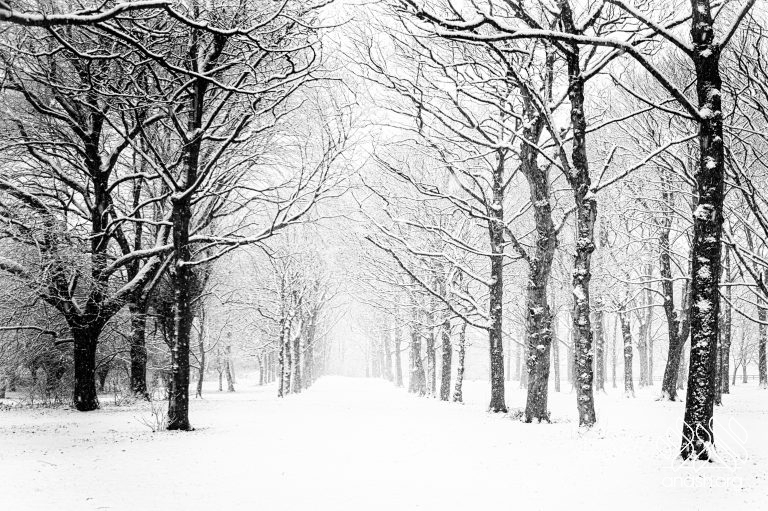
A quickly intensifying winter storm is sweeping into the New York City region, with forecasters warning of heavy, fast-falling snow from late Friday through early Shabbos that could snarl travel by road and air.

A quickly intensifying winter storm is sweeping into the New York City region, with forecasters warning of heavy, fast-falling snow from late Friday through early Shabbos that could snarl travel by road and air.
The National Weather Service has placed New York City, northeast New Jersey, the lower Hudson Valley, and Long Island under winter storm alerts beginning Friday afternoon, with warnings in effect in many areas from 4:00 p.m. Friday through 1:00 p.m. Shabbos.
Snow began moving in during the early afternoon, with conditions expected to deteriorate sharply Friday evening as temperatures drop below freezing. The steadiest and heaviest burst is forecast between roughly 7:00 p.m. and 3:00 a.m., when snowfall rates could reach around an inch per hour – with brief periods of even heavier snow possible. That combination is expected to bring slick roads, reduced visibility, and significant delays for drivers.
Most of the city and surrounding suburbs are projected to pick up about 4 to 8 inches, but forecasters caution that narrow, heavier snow bands could push localized totals close to 10 inches. Some higher amounts are possible in select spots – including Monsey and Kiryas Joel, where 8 to 12 inches or more could fall – while farther south, areas such as Lakewood may see closer to 2 to 4 inches.
Outside the immediate metro area, parts of New Jersey, Pennsylvania, and the Mid-Atlantic are also dealing with a messy mix of sleet and freezing rain, with enough ice accumulation in some locations to raise concerns about downed tree limbs and scattered power outages.
Air travel is already taking a hit. As of early Friday afternoon, more than 1,100 flights had been canceled nationwide, with over 700 tied to the region’s major airports – including JFK, LaGuardia, and Newark. Officials are urging people to avoid unnecessary travel, particularly overnight, as the storm reaches its peak.
City crews are gearing up for round-the-clock operations, with snow-removal equipment and response teams being readied. Residents should still expect slower commutes and possible interruptions to some municipal services as resources shift to storm response.
Snow is expected to taper off early Shabbos, with conditions gradually improving later in the day under mostly cloudy skies – though lingering slick spots may remain even after the steadier precipitation ends.


We appreciate your feedback. If you have any additional information to contribute to this article, it will be added below.